
Home / History / Life in Saxon and Viking times / Buildings and Settlements / Map of Anglo-Saxon England
 [ 1 ]
[ 1 ]  [
[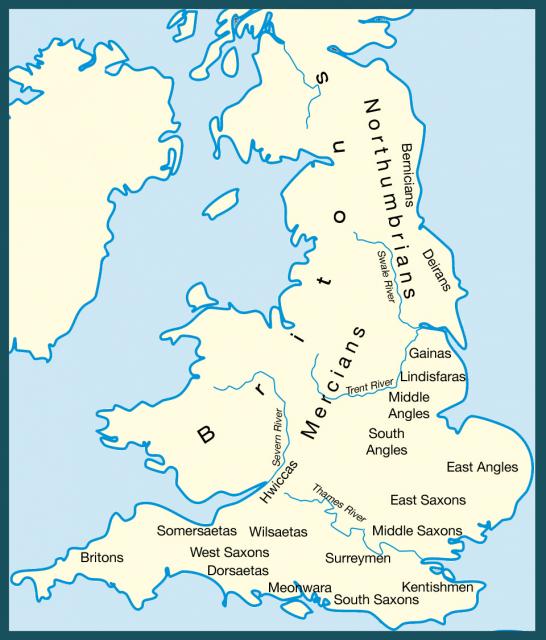
 Map of Anglo-Saxon England
Show/Hide_Details

Added:
20th Aug 2006 by Diane Earl
Subjects:
History
Key Stages:
Key Stage 2, Key Stage 3, Key Stage 4, Key Stage 4+
Keywords:
Anglo-Saxon Saxon Saxons Danes Norse settlement invaders Dark-Ages Celt Roman population invade
Related Links:
EXIF data:Developed by E2BN for the National Education Network
E2B® and E2BN® are registered trade marks and trading names of East of England Broadband Network (Company Registration No. 04649057)
E2B® and E2BN® are registered trade marks and trading names of East of England Broadband Network (Company Registration No. 04649057)