Skip over navigation

NEN Gallery

NEN Gallery
Home / History / Life in Stuart times/Civil War (1603-1713) / Buildings & Settlements / Huntingdon c1610
Asset 1 of 1 Previous Asset [ 1 ] Next Asset   [Slideshow]

Huntingdon c1610

Show/Hide_Details
Download:

640 x 605
656 x 621

Unique Id:

65927

This item is saved in one of your albums. Click to remove it.. My Albums

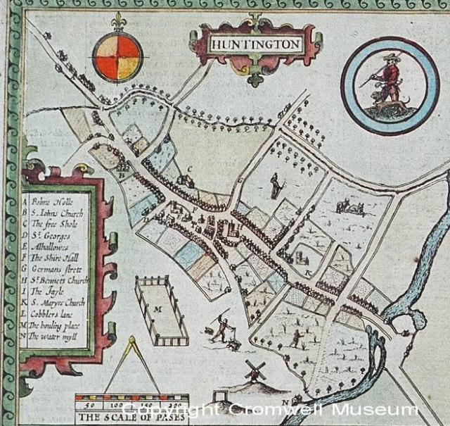
Extract from John Speed's map of Huntingdonshire of 1610. The Museum site is marked as the Free School. Cromwell was a schoolboy when the map was drawn.

Added:
22nd Feb 2007

Subjects:
Design and Technology, English, Geography, History

Key Stages:
Foundation, Key Stage 1, Key Stage 2, Key Stage 3, Key Stage 4, Key Stage 4+

Keywords:
Huntingdon 1610 John Speed Cromwell Grammar School Free School Pepys stuart map

Related Links:


National Education Network
Developed by E2BN for the National Education Network
E2B® and E2BN® are registered trade marks and trading names of East of England Broadband Network (Company Registration No. 04649057)