
Home / Culture and Heritage / First Garden City Heritage Museum / Shopping, past, present & future / Close up of Letchworth's development map, 1936
 [ 1 ]
[ 1 ]  [
[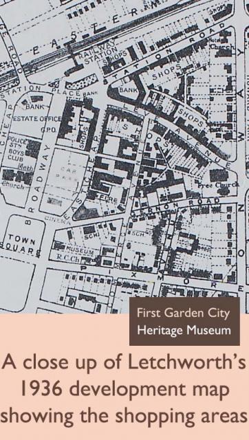
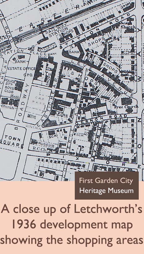
 Close up of Letchworth's development map, 1936
Show/Hide_Details

Added:
29th Aug 2009
Subjects:
Geography, History
Key Stages:
Key Stage 1, Key Stage 2, Key Stage 3, Key Stage 4
Keywords:
map, shopping, shops, Letchworth, garden city, development
Related Links:
EXIF data:Developed by E2BN for the National Education Network
E2B® and E2BN® are registered trade marks and trading names of East of England Broadband Network (Company Registration No. 04649057)
E2B® and E2BN® are registered trade marks and trading names of East of England Broadband Network (Company Registration No. 04649057)