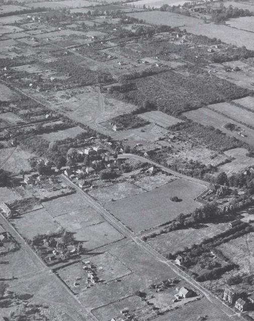
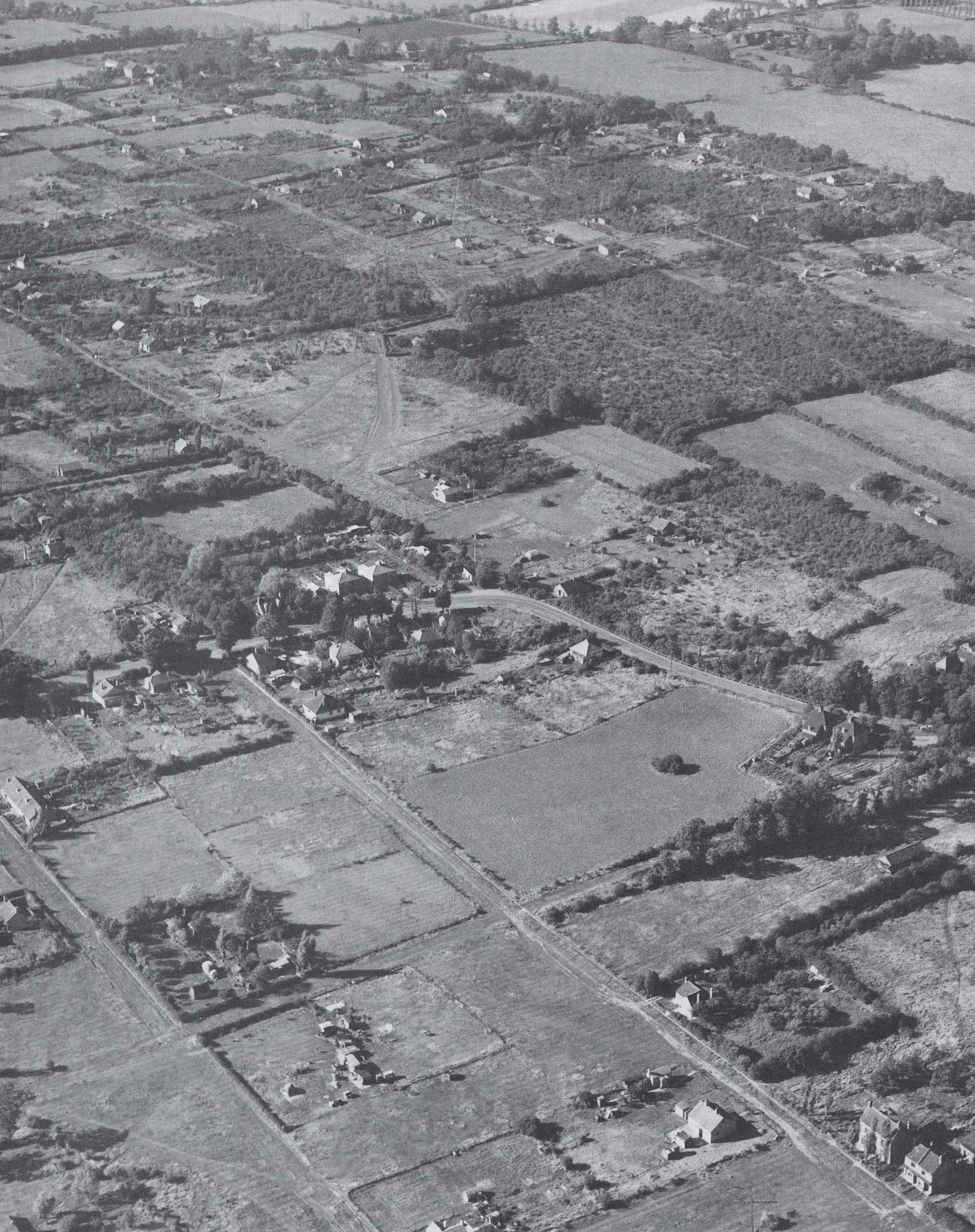
An aerial view of Fryerns before the development of the new town. You can see how much of the land was divided up into small plots with small one-storey individual houses on them. The Plotlands grew because people liked the idea of owning a little area of land where they could build their own house. Few of them had access to services like water or electricity.
The land where the Plotlands were built was bought mostly from farms by railway companies and sold or auctioned to people who lived in the East End of London. Would these settlements have grown up without the railways? How did people there get on without mains water, gas and electricity?
See "Basildon Plotlands", a book by Deanna Walker.
Added:
26th Sep 2008
Subjects:
Design and Technology, Geography, History
Key Stages:
Key Stage 2, Key Stage 3, Key Stage 4
Keywords:
Basildon, local history
Related Links:
EXIF data:| FILE |
| FileName | 1940s_fryerns.jpg |
| FileDateTime | 0 |
| FileSize | 1386617 |
| FileType | 2 |
| MimeType | image/jpeg |
| SectionsFound | ANY_TAG, IFD0, THUMBNAIL, EXIF |
| COMPUTED |
| html | width="1962" height="2479" |
| Height | 2479 |
| Width | 1962 |
| IsColor | 1 |
| ByteOrderMotorola | 1 |
| Thumbnail.FileType | 2 |
| Thumbnail.MimeType | image/jpeg |
| IFD0 |
| Orientation | 1 |
| XResolution | 300/1 |
| YResolution | 300/1 |
| ResolutionUnit | 2 |
| Software | Adobe Photoshop 7.0 |
| DateTime | 2008:09:26 11:16:12 |
| Exif_IFD_Pointer | 156 |
| THUMBNAIL |
| Compression | 6 |
| XResolution | 72/1 |
| YResolution | 72/1 |
| ResolutionUnit | 2 |
| JPEGInterchangeFormat | 294 |
| JPEGInterchangeFormatLength | 5037 |
| EXIF |
| ColorSpace | 65535 |
| ExifImageWidth | 1962 |
| ExifImageLength | 2479 |

 [ 1 ]
[ 1 ]  [
[
 1940s Fryerns