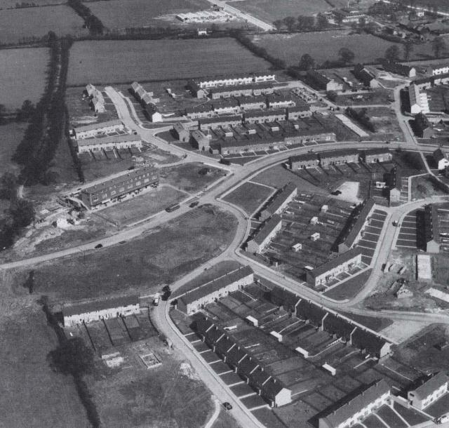
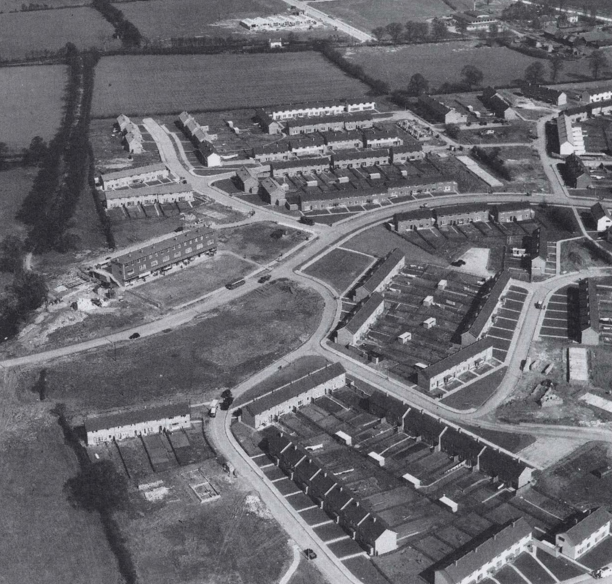
At this stage of the development of Basildon New Town, Fryerns was on the edge of town. We are looking at where Quendon Road meets Whitmore Way. The industrial estate to the north of Cranes Farm Road has not yet been built. The name Cranes appears in the map of 1576, in Raunsden (or Ramsden) Cranes. The first shops in the town centre appeared in 1960, 11 years after the start of making the New Town. Where did people shop before then?
Activity : log onto internet satellite images to see how the area has changed since 1970.
Added:
29th Sep 2008
Subjects:
Geography, History
Key Stages:
Key Stage 2, Key Stage 3, Key Stage 4
Keywords:
Basildon, local history, aerial photograph
Related Links:
EXIF data:| FILE |
| FileName | developed_fryerns_cropped.jpg |
| FileDateTime | 0 |
| FileSize | 1227525 |
| FileType | 2 |
| MimeType | image/jpeg |
| SectionsFound | ANY_TAG, IFD0, THUMBNAIL, EXIF |
| COMPUTED |
| html | width="1224" height="1167" |
| Height | 1167 |
| Width | 1224 |
| IsColor | 1 |
| ByteOrderMotorola | 1 |
| Thumbnail.FileType | 2 |
| Thumbnail.MimeType | image/jpeg |
| IFD0 |
| Orientation | 1 |
| XResolution | 300/1 |
| YResolution | 300/1 |
| ResolutionUnit | 2 |
| Software | Adobe Photoshop Elements 2.0 |
| DateTime | 2008:09:29 00:42:38 |
| Exif_IFD_Pointer | 164 |
| THUMBNAIL |
| Compression | 6 |
| XResolution | 72/1 |
| YResolution | 72/1 |
| ResolutionUnit | 2 |
| JPEGInterchangeFormat | 302 |
| JPEGInterchangeFormatLength | 6455 |
| EXIF |
| ColorSpace | 65535 |
| ExifImageWidth | 1224 |
| ExifImageLength | 1167 |

 [ 1 ]
[ 1 ]  [
[
 1970s Fryerns