
Home / Culture and Heritage / Norfolk Heritage Explorer / Early Roman Forts / Plot of Cropmarks at Thornham Fort
 [ 1 ]
[ 1 ]  [
[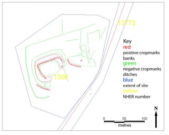
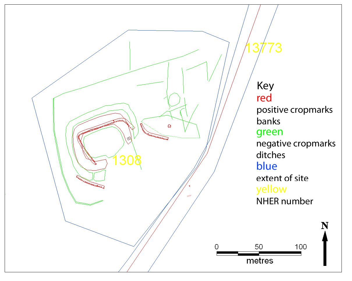
 Plot of Cropmarks at Thornham Fort
Show/Hide_Details

Added:
5th Jun 2007
Subjects:
Art and Design, Design and Technology, English, Geography, History, ICT, Mathematics, Science
Key Stages:
Foundation, Key Stage 1, Key Stage 2, Key Stage 3, Key Stage 4, Key Stage 4+
Keywords:
norfolk, heritage, archaeology, roman, fort, thornham
Related Links:
- Image: Geese in flight
- Image: Marble bust of a young man wearing a toga, found near Rome, circa 240 AD
Developed by E2BN for the National Education Network
E2B® and E2BN® are registered trade marks and trading names of East of England Broadband Network (Company Registration No. 04649057)
E2B® and E2BN® are registered trade marks and trading names of East of England Broadband Network (Company Registration No. 04649057)