


Home / Culture and Heritage / Essex Record Office / Tudor Essex / Map showing the Royal progress of 1561
 [ 1 ]
[ 1 ]  [
[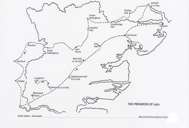
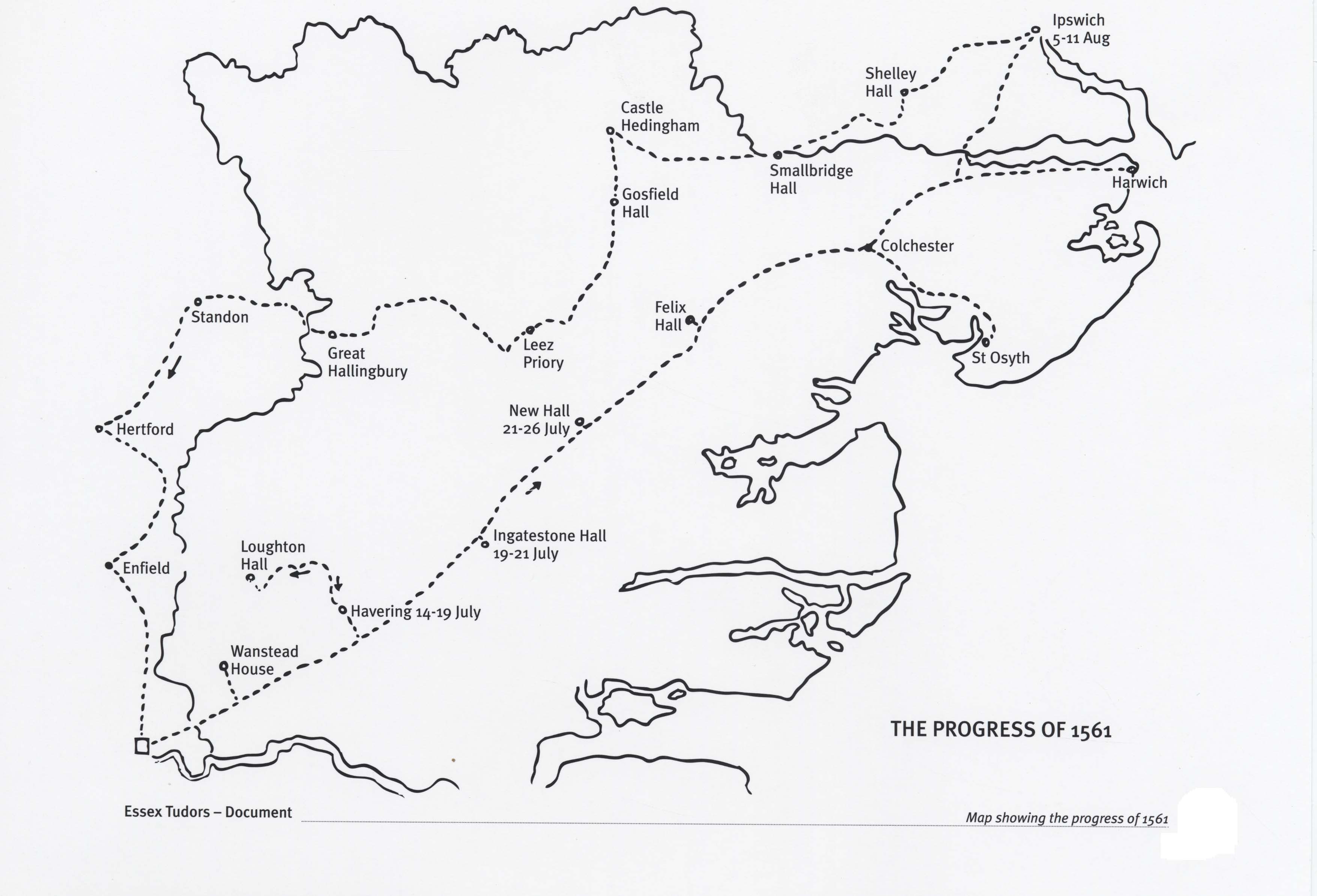
 Map showing the Royal progress of 1561
Show/Hide_Details

Added:
2nd May 2008
Subjects:
English, Geography, History
Key Stages:
Key Stage 2, Key Stage 3, Key Stage 4, Key Stage 4+
Keywords:
Tudor Elizabeth progress maps
Related Links: